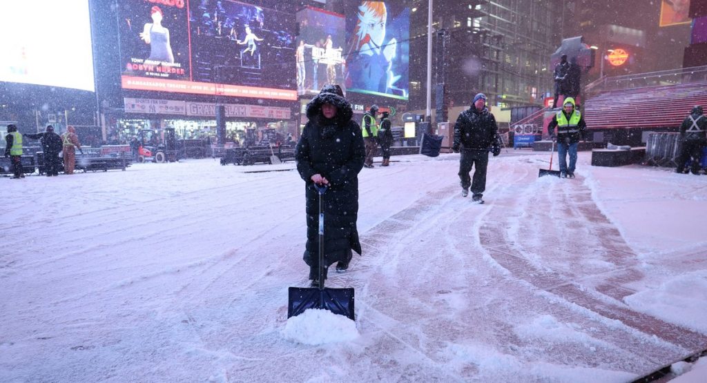
New York City dodged the worst of a holiday-season snowstorm overnight, with just a few inches falling in the five boroughs — but the weather grounded hundreds of flights and is causing delays at regional airports.
Snowfall totals across the city generally ranged from about two to four inches, with similar amounts reported in northeast New Jersey. Central Park did manage 4.3 inches, according to the National Weather service – the first time the park has observed snowfall greater than 4 inches since January 2022.
National Weather Service meteorologist John Murray said totals were lower in the city because of mixed precipitation early in the storm.
“When you have sleet mixing in with the snow, that’ll considerably lower the snowfall total,” Murray said.
City officials said roads were passable with no major issues, but urged drivers to use caution. The Q train was rerouted according to the MTA and city subways reported only scattered delays.
But the storm left thousands of holiday air travelers in the lurch Saturday morning. FlightAware’s Misery Map, which tracks the nation’s airport delays and cancellations, showed metro area airports to be the most miserable in the U.S. Saturday.
As of 9 a.m. Saturday, close to 200 flights were cancelled at JFK, with 137 delayed. At La Guardia 100 flights were canceled with about 70 delays and Newark had more than 100 flight cancellations with 60 delays, according to FlightAware.
Many of the delays resulted from the storm’s impact elsewhere in the Northeast.
The steadiest and heaviest snow fell farther east, including in the lower Hudson Valley, southern Connecticut and across Long Island, Murray said: “They had the higher amount of snow and it was a purely snow event.”
Long Island got between four and six inches while parts of inner Connecticut recorded some of the highest totals, Murray said, “right around nine inches.”
A so-called dry slot, or an area with less atmospheric moisture, also limited snowfall over the city, Murray said. “It introduces a lot less moisture to work with,” resulting in “less precipitation total within those areas.”
Still, the usual cautions remained.
“We still have cold temperatures that are allowing the snowfall to stick to the roads,” Murray said. “Especially secondary roadways … they’ll make for slippery travel.”
New York City’s sanitation department had begun salting Friday and plows had been out throughout the night clearing roads. By Saturday morning, every street in New York city had received “at least one plow and salt pass,” according to the city.
Residents can keep up with plows online.
“The city is operating normally with no major weather-related disruptions,” the department said on X. “Crews are in place, systems are holding steady, and the city continues to monitor conditions closely.”
Looking ahead, Murray said temperatures will rebound before another system arrives with highs near 40 degrees Sunday and “highs in the lower fifties” on Monday.
New Yorkers can also expect some rain Sunday night leading into Monday.

