

NEW YORK (WABC) — A fast-moving clipper system is slowing just enough to pull in Atlantic moisture and bring some snow to New York City and the Tri-State area.
Accumulation will be widespread along the Interstate 95 corridor from Philadelphia to Boston, marking the first general snowfall of the season.
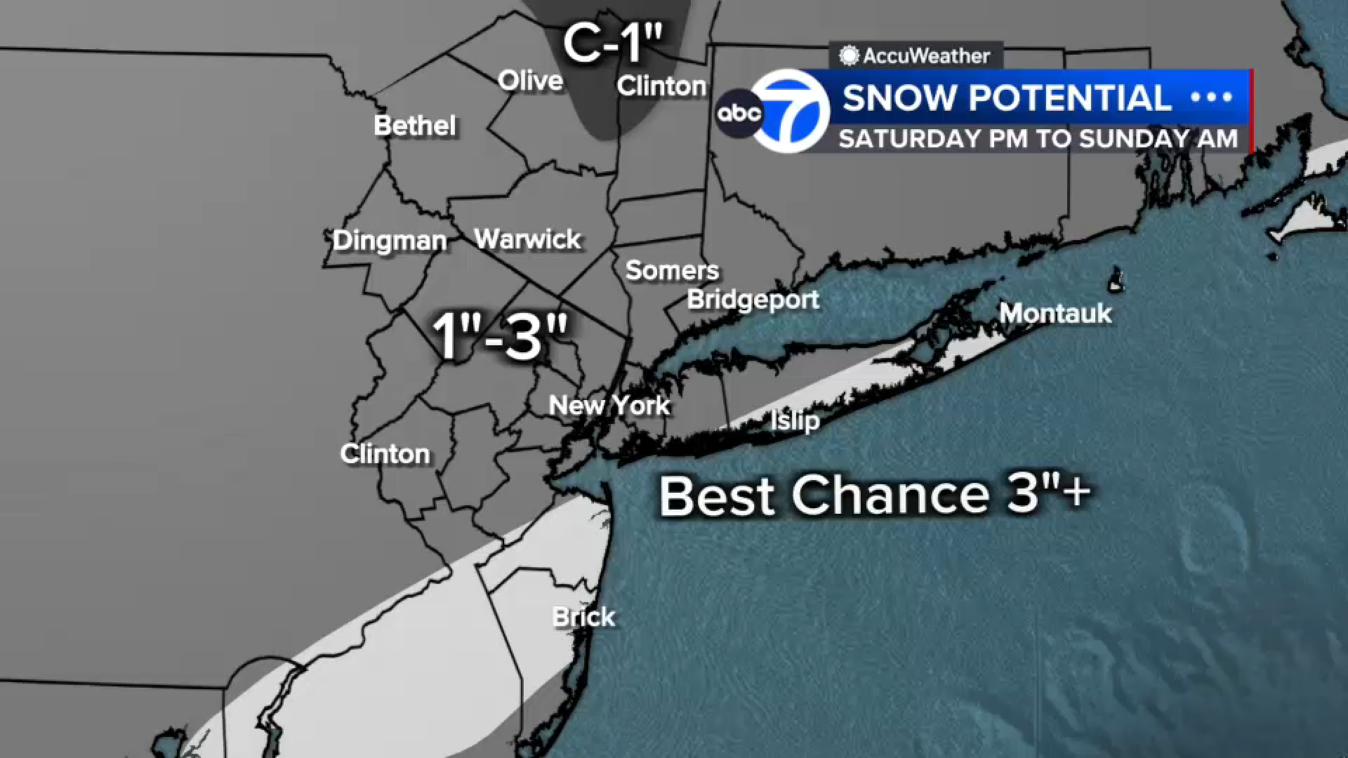
The National Weather Service has isssued a Winter Weather Advisory for New York City, Long Island, and parts of New Jersey for Saturday night into Sunday.
Saturday will begin dry during the daylight hours with increasing clouds.
Snow is expected to develop late Saturday night, around 10-11 p.m., and continue into early Sunday morning.
Accumulations will average 1-3 inches across the Tri-State area, with lighter amounts north and west of I-287 and heavier totals – up to 3 inches or more – south and east of New York City, including Suffolk, Ocean, and Monmouth counties.
Though totals will be modest, expect slippery roads and possible airport disruptions due to de-icing operations.
Conditions will clear by Sunday afternoon, though temperatures will remain below freezing.
High pressure returns Monday, bringing bright but frigid weather with highs in the upper 20s to low 30s. A gradual warm-up is expected midweek, with temperatures reaching near 50F by Thursday.

Please fill out the form below to submit weather photos and videos. Upload your photo/video on the second screen!
Terms of use apply.
Follow the ‘Weather or Not’ podcast with Lee Goldberg
MORE ACCUWEATHER RESOURCES
Check AccuTrack Radar
Air Quality Tracker
NWS Advisories, Watches and Warnings
School closings and delays
For weather updates wherever you go, please download the AccuWeather app.
Follow meteorologist Lee Goldberg, Sam Champion, Brittany Bell, Jeff Smith, and Dani Beckstrom on social media.
Copyright © 2025 WABC-TV. All Rights Reserved.